
Loading…
Loading…
Pathanamthitta is mostly forest, river and plantation, with a pilgrimage route running through it. Where land, water and crowds matter this much, a shared web map is a working tool.
Or call +91 62358 66111
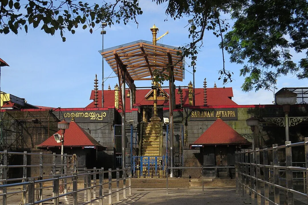
Photo: bhanukhan · Pixabay Content License · via Pixabay
Trusted by 200+ organisations across India & overseas — including





























WebGIS is a specialised service, and in Pathanamthitta the honest list of users is short: local bodies, government departments, plantation companies, utilities and a few tourism operators. For them, though, the case is strong. A large share of the district is reserved forest. The Pamba, Achankovil and Manimala rivers flood settled valleys. Rubber estates spread over hill slopes in Konni and Ranni. Each season, vast crowds move along one corridor from Nilakkal to Pamba.
Acube builds WebGIS applications on open technology such as PostGIS, QGIS, Leaflet and OpenLayers: interactive maps with layers, search and filters, field data collection apps with GPS, spatial analysis and dashboards. There is no per-seat licence to pay, and you own the system and its data.

Case studies

Kerala State Road Transport Corporation (KSRTC)
KSRTC — ERPNext Courier System Delivered ₹1 Crore in Profit

Dumas Bakes N Meals Private Limited
Dumas Bakes N Meals — ERPNext Lifted On-Time Deliveries by Over 40%

JPC Enterprises
JPC Enterprises — ERPNext Cut Procurement Delays 40% on Offshore EPC Projects
A municipality knows it has streetlights, culverts and water connections but not precisely where each is or when it was last repaired. Mapping them turns complaints into located work orders and helps engineers plan budgets ward by ward.
Plantation managers plan replanting, tapping blocks and road repairs from old survey sheets. A web map with block boundaries, planting year, clone, yield and slope lets the manager in Konni and the company's directors see the same picture.
Relief camps, vulnerable houses, parking areas, medical posts and water points sit in spreadsheets across departments. One shared map, updated from the field by phone, helps teams coordinate when the river rises or the season peaks.
An example
Rain has fallen on the hills for two days and the gauge at the bridge is climbing. At a block office in the Ranni area the overseer opens the shared map rather than three spreadsheets. The layer of vulnerable houses along the Pamba is there from last year's survey, with the families' phone numbers attached. The relief camp at a school on higher ground is marked with its capacity and the officer in charge. A field worker on the forest road drops a pin where water has crossed the tarmac, with a photograph, and every screen in the office and at headquarters updates. When the control room asks which roads are cut, the answer is a link, not a phone call, and the same map will show parking and water points when the pilgrims come in November.
WebGIS projects start with the data you already hold: survey sheets, shapefiles, spreadsheets with coordinates, or nothing digital at all. We review it, often on site at your Pathanamthitta premises, agree the layers and users, and build a first working map quickly so that discussion is concrete. Field teams are trained in person on the mobile app. Hosting and support run from Kochi.
Discovery and data audit. Your spatial data and the decisions the map must support.
Data model. Your data modelled in a spatial database, clean and ready to scale.
Map and application design. Layers, filters, search, dashboards and field capture around your users.
Integration. The map connected to your ERP, asset registers and GPS feeds.
Deploy, train and support. Launched on a stack you control, your team trained, support kept on.
The scope and timeline are agreed in writing before work starts.
Natural rubber and plantations
Estate block mapping with area, age and yield data, GPS-tagged inspection rounds, replanting plans, and boundary records that support lease and compliance paperwork.
Pilgrimage tourism and hospitality
Maps of facilities, parking, rest points, medical aid and transport along the Pamba corridor for agencies and service operators, plus visitor maps for eco-tourism circuits at Gavi and Konni.
Construction and real estate
Land parcel and project location maps for developers and surveyors, overlaying flood levels, road access and zoning, useful when advising NRI buyers who cannot visit the plot.
It can be, if scoped tightly. Start with one problem, such as streetlight maintenance or property mapping for tax, not an all-purpose system. Open-source tools carry no licence fee, and field staff collect data on ordinary phones.
No. The application is built for ordinary users: clerks, overseers, field officers and managers. They search, filter and update through a browser or phone. Specialist analysis, when needed, is something we provide or train a nominated person for.
Usually. Paper maps are scanned and georeferenced; digital drawings and shapefiles are imported. Accuracy depends on the source, and we record that against each layer. Fresh GPS or drone surveys fill gaps where the old record is poor.
After a first conversation about your spatial data, the users and the decisions the map has to support, we agree the scope and send you a written quotation. The price, the deliverables and the timeline are fixed against that scope before any work starts, so nothing grows without your sign-off.
You speak to someone who does this work, not a call centre. They ask about the data you hold, who needs to see it on a map and what they decide from it. If it looks like a fit, we agree the scope and put it in writing, with the timeline, before any work starts. If it does not, we tell you.
Pathanamthitta District Panchayatlocal body
The apex local body for eight blocks and dozens of grama panchayats; roads, water schemes and relief plans across that area are easier to fund and audit as located records.
Ranni Block Panchayatlocal body
A hill block on the Pamba, flood-prone and on the road to the pilgrimage, where one map must serve river-level planning in the monsoon and crowd management in the season.
Konni Block Panchayatlocal body
Forest-edge villages, an elephant training centre and rubber slopes; estate boundaries, forest limits and eco-tourism routes here are all questions of where exactly.
Places and organisations are named for local context only. Acube Innovations is not affiliated with or endorsed by them.
Everything about WebGIS Development All services in Pathanamthitta
More services in Pathanamthitta
Get a clear plan, an honest timeline, and a fixed scope. Talk to a real expert today — whether or not you work with us.
or write to info@acube.co
Kochi (Kadavanthra & Infopark) · Thiruvananthapuram · across India & overseas · In business since 2011