
Loading…
Loading…
Also serving Kalpetta
Wayanad is a district of slopes, forest edges and scattered estates, where almost every decision has a location attached; a web map makes those decisions visible.
Or call +91 62358 66111
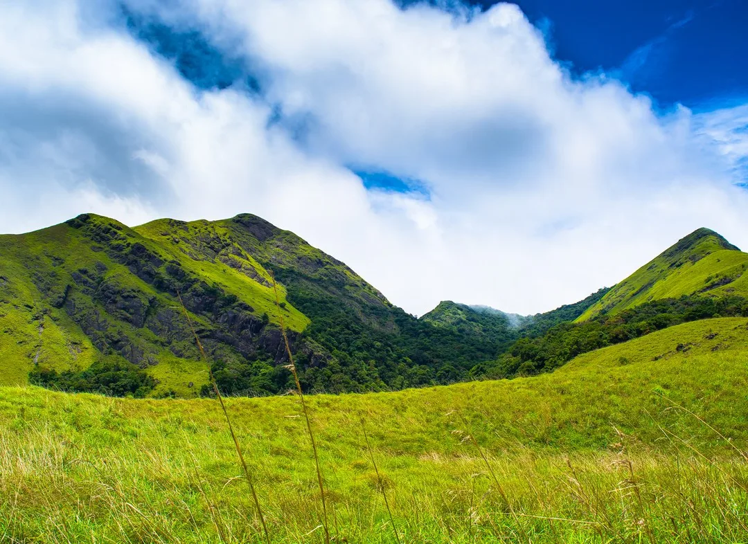
Photo: Karkiabhijeet · CC BY-SA 4.0, cropped · via Wikimedia Commons
Trusted by 200+ organisations across India & overseas — including





























WebGIS is a specialised tool, and in Wayanad its users are few but real. Estate groups managing blocks across several hills. Panchayats and municipalities in Kalpetta, Sulthan Bathery and Mananthavady that must know where roads, water lines and buildings stand. Tourism bodies and trek operators working along forest boundaries. Agencies planning for landslip and flood risk. Each works today from paper maps, memory and spreadsheets with village names in a column.
Acube builds web-based GIS applications on open-source technology such as PostGIS, QGIS, Leaflet and OpenLayers. Your data is placed on an interactive map with layers, search, filters and reports, opened in a browser with no licence per user. Field staff can capture GPS-tagged records on a phone. For a Wayanad organisation the usual starting point is one clear question the map must answer.
Case studies

Kochi Metro Rail Limited (KMRL)
Kochi Metro (KMRL) — ERPNext Property & Lease Management, Zero Paper

Della Fashions
Della Fashions — ERPNext POS Made Checkout 60% Faster Across Every Outlet

Dumas Bakes N Meals Private Limited
Dumas Bakes N Meals — ERPNext Lifted On-Time Deliveries by Over 40%
A plantation knows each block by name, but planting year, variety, shade, yield and replanting plans live in separate registers. Placing blocks on a map and linking those records shows at a glance which areas underperform.
Where a culvert, a pipeline or a streetlight line runs is often known only to a long-serving overseer. A web map of assets, updated from the field, keeps that knowledge with the institution and supports maintenance and estimates.
In a district with steep terrain and heavy monsoon, knowing which houses, roads and properties lie on vulnerable slopes or beside streams matters. A map combining terrain, rainfall and settlement layers helps planners prepare rather than react.
An example
A panchayat overseer in Meenangadi walks his ward on a dry morning with an ordinary Android phone. At each culvert he taps a point on the map, adds a photograph and a condition note, and moves on; where there is no signal the record waits and uploads at the office. By noon the ward's drains, streetlight lines and the water pipeline the retired overseer used to keep in his head are on one layer in the browser. The secretary filters for culverts marked poor and overlays the stream layer to see which sit where the monsoon water gathers. The maintenance estimate for the next council meeting is built from that list, with each item located, rather than from a walk of memory and a hand-drawn sketch.
A WebGIS engagement starts by agreeing the question the map must answer and checking what data exists: survey sketches, revenue maps, GPS points or nothing at all. We visit Wayanad for that assessment and for field data collection training. Development is done in Kochi and shown to you in working stages. The finished application is hosted for you, and the data and code are yours.
Discovery and data audit. Your spatial data and the decisions the map must support.
Data model. Your data modelled in a spatial database, clean and ready to scale.
Map and application design. Layers, filters, search, dashboards and field capture around your users.
Integration. The map connected to your ERP, asset registers and GPS feeds.
Deploy, train and support. Launched on a stack you control, your team trained, support kept on.
The scope and timeline are agreed in writing before work starts.
Coffee and pepper plantations
Block-wise maps with area, crop, age and yield attributes, GPS-tagged field observations on pests or shade work, and simple analysis of output by block, slope or elevation across the holdings.
Tea estates
Division and field boundaries, plucking round tracking by field, road and drainage layers within the estate, and records of replanting and infilling tied to the place on the ground where they occurred.
Eco and adventure tourism
Trail and site maps with difficulty, distance and safety points, capacity and closure management for operators and destination managers, and visitor-facing maps that work on a mobile browser.
With what you have: estate sketches, survey numbers or simply a supervisor walking the boundary with a phone. We help digitise boundaries from existing documents and GPS walks, and build the base layers first. Accuracy improves in later stages.
No, though local bodies are natural users. In Wayanad, plantation groups, tourism operators, cooperatives mapping member farms and organisations working on conservation all have practical uses. If a spreadsheet already answers your question, we will say a map is unnecessary.
No. We build on open-source GIS software, so there are no per-user licence fees and you are not tied to one supplier. Users need only a browser, and field staff an ordinary Android phone.
After a first conversation about your spatial data, the users and the decisions the map has to support, we agree the scope and send you a written quotation. The price, the deliverables and the timeline are fixed against that scope before any work starts, so nothing grows without your sign-off.
You speak to someone who does this work, not a call centre. They ask about the data you hold, who needs to see it on a map and what they decide from it. If it looks like a fit, we agree the scope and put it in writing, with the timeline, before any work starts. If it does not, we tell you.
Meenangadi Grama Panchayatlocal body
Kerala's first carbon-neutral panchayat project began here, and tree, land-use and asset records tied to places on a map are how such a programme is planned and reported.
Mananthavady Municipalitylocal body
A municipality of roads, drains and water lines across hilly wards, where an asset map updated from the field replaces knowledge held by a few long-serving staff.
Regional Agricultural Research Station, Ambalavayalinstitution
Kerala Agricultural University's high-range research station, working on spices, sub-tropical fruits, vegetables and hill paddy
The research station's work on spices, fruit and hill paddy is location-bound, and trial plots and farm observations gain from a map layer with GPS-tagged records.
Source: keralatourism.orgPlaces and organisations are named for local context only. Acube Innovations is not affiliated with or endorsed by them.
Everything about WebGIS Development All services in Wayanad
More services in Wayanad
Get a clear plan, an honest timeline, and a fixed scope. Talk to a real expert today — whether or not you work with us.
or write to info@acube.co
Kochi (Kadavanthra & Infopark) · Thiruvananthapuram · across India & overseas · In business since 2011