
Loading…
Loading…
Kottayam is not a big GIS market, but its rubber holdings, panchayats and field networks are spread across hills and backwaters that a spreadsheet cannot picture.
Or call +91 62358 66111
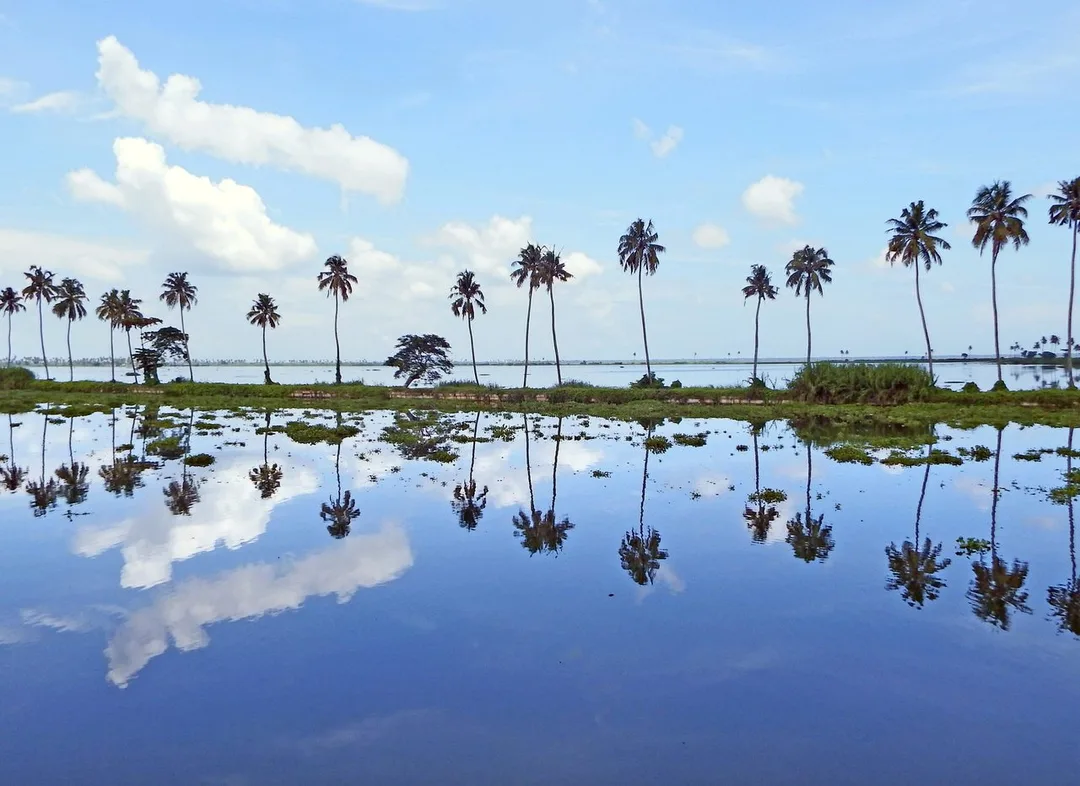
Photo: Rison Thumboor · CC BY-SA 4.0, cropped · via Wikimedia Commons
Trusted by 200+ organisations across India & overseas — including




























We will be plain: most Kottayam businesses do not need a mapping system. The ones that do share a feature. Their work is scattered across land. A plantation company with holdings from Mundakkayam to Erattupetta, a rubber producers' society collecting from smallholders along winding roads, a panchayat tracking roads, drains and streetlights, a hospital running outreach camps. For them, location is the missing column in every report.
WebGIS puts your data on an interactive map in a browser. We build on open tools such as PostGIS, Leaflet, OpenLayers and QGIS, so there is no per-seat licence. Typical features are layers and filters, search, asset and boundary mapping, GPS-tagged field data collection through a mobile app, routing and proximity analysis, and area-wise reports. The map can draw from ERPNext, so commercial figures and locations appear together.

Case studies

Indus Motor Company Private Limited
Indus Motor — ERPNext Cut Stock-Outs 40% Across Showrooms
Queue Off
Queue Off — Digital Payments That Work on a Feature Phone, With No Internet

Della Fashions
Della Fashions — ERPNext POS Made Checkout 60% Faster Across Every Outlet
Block boundaries, planting years and access paths often live in the memory of a long-serving supervisor. Mapping them once, with GPS, gives the estate a record that survives retirement and supports replanting and input planning.
Procurement vehicles follow routes fixed years ago, though growers and volumes have changed. Plotting suppliers and quantities on a map shows where routes overlap, where a new collection point would help, and which areas are under-served.
Panchayats and municipalities in Kottayam district maintain roads, culverts, lights and water points with paper files. A simple web map with each asset's condition and last repair makes complaints, budgets and flood-season preparation easier to handle.
An example
A panchayat engineer near Kaduthuruthy spends a morning walking the low-lying wards with the field app open. At each culvert and drain she taps its position, takes a photograph and marks its condition; the app stores everything on the phone where the signal fails and uploads it when she reaches the office. On the web map that afternoon the president sees the culverts marked red along one road and the complaints from last year's flooding plotted beside them. The clearing work is listed by ward and given to the contractor with the map as the work order. In the eastern hills a plantation manager opens the same kind of map for his estate and sees blocks by planting year, with last season's yield shaded, and decides where to replant.
GIS work needs ground truth, so a Kottayam project includes field days: walking boundaries with your supervisors, checking GPS points, and collecting existing survey sheets or shapefiles. Development is done in Kochi. We deliver in stages, beginning with a base map of your own data, so that you see value before analysis features are added.
Discovery and data audit. Your spatial data and the decisions the map must support.
Data model. Your data modelled in a spatial database, clean and ready to scale.
Map and application design. Layers, filters, search, dashboards and field capture around your users.
Integration. The map connected to your ERP, asset registers and GPS feeds.
Deploy, train and support. Launched on a stack you control, your team trained, support kept on.
The scope and timeline are agreed in writing before work starts.
Plantation agriculture (rubber, spices)
Block-wise estate maps with area, age, clone or crop, and yield linked from records, plus field apps for supervisors to log tapping, disease or damage at the exact spot.
Natural rubber procurement
Supplier and depot mapping for rubber and latex buying, route planning for collection vehicles, and area-wise purchase analysis that shows where a dealer or society is gaining or losing growers.
Education and healthcare
Catchment maps for hospitals and colleges showing where patients or students come from, planning of outreach camps and bus routes, and survey tools for university research teams.
No. We build on open, standards-based software, so you pay for development and hosting but not per-user licences. You own the code and the data. Existing shapefiles, CSV files with coordinates and GPS tracks can all be imported.
Possibly not as a standalone system. For a small holding, a simple GPS survey and a map layer inside a wider plantation or ERPNext setup may be enough. We would sooner recommend the smaller option than build something you will not use.
Yes. The field app stores data on the phone and syncs when a connection returns, which suits the hilly eastern parts of Kottayam district. Base maps for your area can be kept on the device for use offline.
After a first conversation about your spatial data, the users and the decisions the map has to support, we agree the scope and send you a written quotation. The price, the deliverables and the timeline are fixed against that scope before any work starts, so nothing grows without your sign-off.
You speak to someone who does this work, not a call centre. They ask about the data you hold, who needs to see it on a map and what they decide from it. If it looks like a fit, we agree the scope and put it in writing, with the timeline, before any work starts. If it does not, we tell you.
Kottayam District Panchayatlocal body
The district panchayat oversees roads, water points and buildings across five taluks; a web map with each asset's condition is how a public body plans before the rain.
Source: kottayam.nic.inVaikom Block Panchayatlocal body
Vaikom's wards sit on the Vembanad shore and flood first; mapping drains, culverts and relief points is the practical GIS use here, not analysis for its own sake.
Source: kottayam.nic.inKaduthuruthy Block Panchayatlocal body
Low-lying panchayats around Kaduthuruthy maintain bunds and drains from paper files; a simple asset map with photographs and last-repair dates changes flood-season planning.
Source: kottayam.nic.inDIC Mini Industrial Estates (Aymanam, Erattupetta, Karukachal, Kumaranalloor, Madappally, Mutholy, Manimala, Paippad, T.V. Puram, Vijayapuram, Kanjirappally)park
Eleven small shed-based estates of 9-10 units each spread across the taluks, run through the District Industries Centre and co-operative societies
Eleven mini estates spread across the taluks are hard to see as one network; plotting them with their units and vacancies is a small, useful map for the industries office.
Source: industry.kerala.gov.inPlaces and organisations are named for local context only. Acube Innovations is not affiliated with or endorsed by them.
Everything about WebGIS Development All services in Kottayam
More services in Kottayam
Get a clear plan, an honest timeline, and a fixed scope. Talk to a real expert today — whether or not you work with us.
or write to info@acube.co
Kochi (Kadavanthra & Infopark) · Thiruvananthapuram · across India & overseas · In business since 2011