
Loading…
Loading…
Also serving Trivandrum
As the seat of government and home to a new deep-water port, Thiruvananthapuram has more map-dependent decisions than any other Kerala district. WebGIS puts them in a browser.
Or call +91 62358 66111
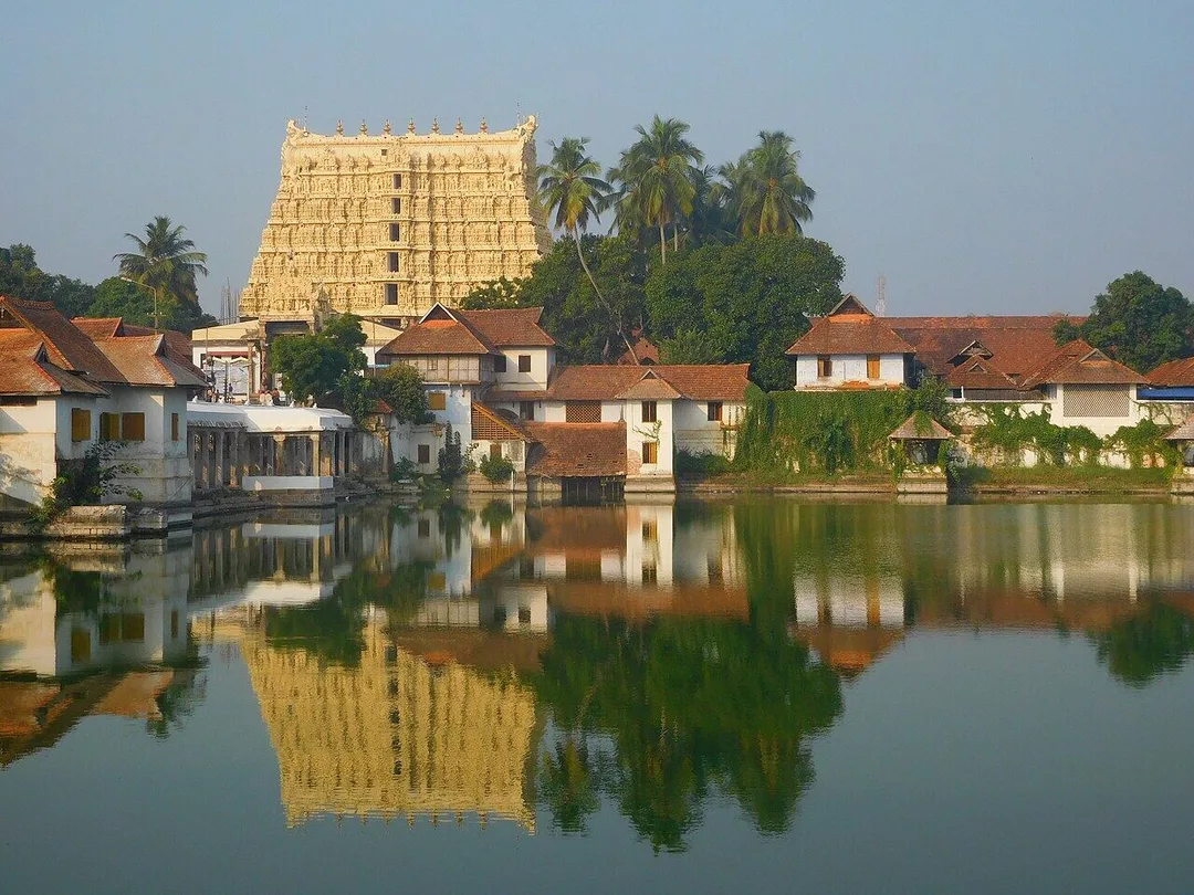
Photo: Shishirdasika · CC BY-SA 4.0, cropped · via Wikimedia Commons
Trusted by 200+ organisations across India & overseas — including






























WebGIS is a natural fit here. State departments, boards and local bodies headquartered in the capital manage roads, water lines, land, forests and coastline, and most of that knowledge still lives in paper maps, desktop GIS files on one officer's computer, or spreadsheets with a location column. Meanwhile the port is drawing new roads, yards and land-use questions along the southern coast.
We build web-based GIS applications on open-source technology such as PostGIS, QGIS, OpenLayers and Leaflet. Users open a browser, see their assets or survey data on a live map, filter, measure and report, and field staff update records from a phone. There is no per-seat licence, and the organisation owns both the code and the data.
Case studies

Indus Motor Company Private Limited
Indus Motor — ERPNext Cut Stock-Outs 40% Across Showrooms

Biotech Research Society, India (BRSI)
BRSI — Association Management Software for a National Scientific Society

Kerala State Road Transport Corporation (KSRTC)
KSRTC — ERPNext Courier System Delivered ₹1 Crore in Profit
A single GIS operator holds the layers, and everyone else waits for a printout. A web application makes the same data available to every authorised officer, with roles deciding who can view, edit and approve, and every edit recording who changed what.
Survey teams record on paper and someone enters it weeks later. Mobile data capture with GPS location, photographs and offline support sends each record to the central map as soon as the phone finds a signal.
Which valve serves which ward, where a cable crosses a road, which plots a project touches. Putting utilities and assets on a queryable map protects that knowledge when experienced staff retire or are transferred.
An example
Two junior engineers walk a ward in the Neyyattinkara area on a Monday morning with a tablet. Each street light and each valve chamber is recorded where it stands, with a photograph and its condition, and the point appears on the office map within seconds. Halfway along a lane the signal drops; entries queue on the device and upload at the junction. At the municipal office the assistant engineer watches the ward fill in through the day and marks four chambers for repair without waiting for a report. By Friday the ward layer is complete, and the estimate for the next works file is drawn from it rather than from memory.
We begin by taking stock of the spatial data you already hold, its formats and its quality, since that decides most of the effort. A pilot layer and viewer come first, then editing, field capture and reports. Requirement workshops and training take place in Thiruvananthapuram, and the system can be hosted on approved or private infrastructure.
Discovery and data audit. Your spatial data and the decisions the map must support.
Data model. Your data modelled in a spatial database, clean and ready to scale.
Map and application design. Layers, filters, search, dashboards and field capture around your users.
Integration. The map connected to your ERP, asset registers and GPS feeds.
Deploy, train and support. Launched on a stack you control, your team trained, support kept on.
The scope and timeline are agreed in writing before work starts.
Government and public administration
Departments, development authorities and local bodies map assets, works, land parcels and service coverage, link each feature to its file or scheme, and publish selected layers to the public through a simple viewer.
Ports and logistics
Operators and planners around Vizhinjam visualise yards, approach roads, warehouses and vehicle movement, plan routes and study land along the corridor, combining GPS feeds with base maps and ownership layers.
Tourism and hospitality
Tourism bodies and operators publish interactive maps of destinations from Kovalam to Ponmudi, with trails, amenities and accessibility information, and see where visitors go and where facilities fall short.
Desktop GIS remains useful for specialists. WebGIS is for everyone else: officers, engineers and managers who need to see and query maps without training or a licence each. The two work together, reading the same spatial database.
Yes. Because the stack is open source, it can run in a state data centre, on an approved cloud or on your own servers. We document the architecture and security settings for the hosting authority's review.
Usually. Paper maps can be scanned and georeferenced, and CAD drawings converted into GIS layers, though accuracy depends on the originals. We assess a sample first and tell you what can be trusted and what needs resurvey.
After a first conversation about your spatial data, the users and the decisions the map has to support, we agree the scope and send you a written quotation. The price, the deliverables and the timeline are fixed against that scope before any work starts, so nothing grows without your sign-off.
You speak to someone who does this work, not a call centre. They ask about the data you hold, who needs to see it on a map and what they decide from it. If it looks like a fit, we agree the scope and put it in writing, with the timeline, before any work starts. If it does not, we tell you.
Thiruvananthapuram District Panchayatlocal body
Works, roads and water assets spread across grama panchayats and blocks are managed by officers who move on transfer, so a shared map outlives the individual who surveyed it.
Neyyattinkara Municipalitylocal body
A municipality of this size holds street lights, drains and waste points in registers and memory, which is exactly the asset inventory a queryable map replaces first.
Nedumangad Municipalitylocal body
Hill-side wards with scattered settlements make service coverage hard to judge from a table, and a map answers in one view which stretches have no connection.
Vizhinjam International Seaporttransport
deepwater container transshipment port developed by the state under a landlord PPP model; commercial operations from 2024, direct EXIM cargo from August 2026
New approach roads, yards and land-use pressure along the southern coast raise planning questions that are far easier to settle with layers than with a file note.
Source: vizhinjamport.inPlaces and organisations are named for local context only. Acube Innovations is not affiliated with or endorsed by them.
Everything about WebGIS Development All services in Thiruvananthapuram
More services in Thiruvananthapuram
Get a clear plan, an honest timeline, and a fixed scope. Talk to a real expert today — whether or not you work with us.
or write to info@acube.co
Kochi (Kadavanthra & Infopark) · Thiruvananthapuram · across India & overseas · In business since 2011