
Loading…
Loading…
Also serving Palghat
Palakkad's paddy fields, irrigation canals and industrial plots are all questions of where; WebGIS puts them on one shared map for the bodies that manage them.
Or call +91 62358 66111
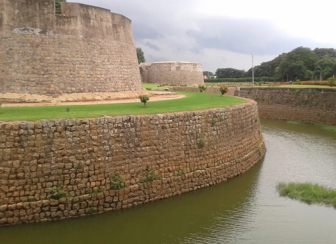
Photo: Vis M · CC BY-SA 4.0, cropped · via Wikimedia Commons
Trusted by 200+ organisations across India & overseas — including





















WebGIS is not an everyday purchase in Palakkad, and most private firms here will never need it. The honest market is narrower: municipalities and panchayats, irrigation and agriculture agencies, co-operatives and producer companies working across many padasekharams, and estate managers in the Kanjikode belt. What they share is information tied to land, kept in registers, spreadsheets and field staff's memory.
We build web-based maps on open-source GIS tools, so there are no per-seat licence fees. Layers such as survey plots, canals, roads and assets are combined with your own records, searched and filtered in a browser, and updated from the field through a mobile app. For a district shaped by the Malampuzha command area, a shared map settles arguments that paperwork cannot.

Case studies
Kochi Metro Rail Limited (KMRL)
Kochi Metro (KMRL) — ERPNext Property & Lease Management, Zero Paper

Connect N Cabs Tours & Travels Pvt. Ltd.
Connect N Cabs — A Custom Travel ERP That Lifted Fleet Utilisation 35%

Della Fashions
Della Fashions — ERPNext POS Made Checkout 60% Faster Across Every Outlet
A producer company or society working with growers across Alathur and Chittur holds member lists without locations. Mapping each holding, with variety, sowing date and expected harvest, lets procurement be planned by area and route.
Municipal and panchayat staff maintain roads, streetlights, drains and buildings from ledgers. When a complaint comes, nobody can see what else is nearby or when it was last repaired. A WebGIS asset layer with maintenance history makes works planning visible to officials and members.
Estate layouts around Kanjikode exist as ageing paper drawings: plot boundaries, water lines, power feeders, drains. A digital, queryable map shows which plots are vacant, what services reach them and what runs beneath before anyone digs.
An example
On a Tuesday morning in the monsoon, a ward engineer at Palakkad Municipality opens the drainage layer after a flooding complaint from a street off Market Road. The pin from the complaint app sits on a drain section the map shows was desilted the previous year. He sees that the blocked culvert downstream belongs to a different work, and reassigns the job to the right crew from the same screen. In the afternoon the council's works committee looks at the ward on a projector, sees which roads were resurfaced and which are due, and agrees next year's list.
A WebGIS project starts with an inventory of the data you already hold: survey sketches, spreadsheets, GPS files, drawings. We visit Palakkad to meet the people who know the ground, and where needed we train your field staff to capture locations with a phone. The build and hosting are handled from Kochi. Because the platform is open source, the finished system and its data belong to you.
Discovery and data audit. Your spatial data and the decisions the map must support.
Data model. Your data modelled in a spatial database, clean and ready to scale.
Map and application design. Layers, filters, search, dashboards and field capture around your users.
Integration. The map connected to your ERP, asset registers and GPS feeds.
Deploy, train and support. Launched on a stack you control, your team trained, support kept on.
The scope and timeline are agreed in writing before work starts.
Paddy and agriculture
Holding-level maps for producer companies and co-operatives, canal and command area layers for water planning, field data captured by extension staff on mobile, and harvest and procurement planning by cluster.
Logistics and warehousing
Site selection analysis along the Walayar to Palakkad stretch of NH 544, catchment and drive-time maps for depots, and live vehicle positions from GPS feeds shown against customers and routes.
Manufacturing and engineering (Kanjikode)
Estate and campus maps for large plants and industrial parks showing plots, utilities, fire and safety assets and underground services, linked to maintenance records.
It can be. If your need is a handful of locations, a simple shared map may do and we will say so. WebGIS justifies itself when there are many features, several users, regular updates and decisions that depend on seeing things together.
Where you have lawful access to it, yes. Cadastral maps, ward boundaries and publicly available base maps and satellite imagery can be used as layers. Your own information is drawn on top, and access is controlled by user role.
It can. An asset, customer or grower record in ERPNext can carry a location and appear on the map, and a click on the map can open the ERP record. For a Palghat co-operative, that links a member's holding to his deliveries and payments in one view.
After a first conversation about your spatial data, the users and the decisions the map has to support, we agree the scope and send you a written quotation. The price, the deliverables and the timeline are fixed against that scope before any work starts, so nothing grows without your sign-off.
You speak to someone who does this work, not a call centre. They ask about the data you hold, who needs to see it on a map and what they decide from it. If it looks like a fit, we agree the scope and put it in writing, with the timeline, before any work starts. If it does not, we tell you.
Palakkad Industrial Smart City (Kochi–Bengaluru Industrial Corridor node)park
About 1,710-acre node of the Kochi–Bengaluru Industrial Corridor approved by the Union Cabinet in August 2024; land largely acquired, master plan and tendering still pending as of the article. Planned, not operating — do not present it as live.
A planned greenfield node, not yet built, whose plot allotment and utility planning are map problems from the first day, best designed before the first plot is let.
Source: en.wikipedia.orgIntegrated Rural Technology Centre (IRTC)institution
KSSP-founded R&D centre (1987) in the district working on waste, water, energy and livelihood technology for local bodies
A district R&D centre working with local bodies on waste, water and energy, the kind of partner whose field data belongs on a shared map rather than in separate reports.
Source: en.wikipedia.orgPalakkad Municipalitylocal body
The district's largest local body, maintaining roads, drains, lights and buildings across the town. An asset layer with maintenance history is the clearest municipal use of WebGIS.
Source: palakkad.nic.inPalakkad Gap and NH 544 / NH 966transport
the 32–40 km break in the Western Ghats through which road and rail from Tamil Nadu enter Kerala; NH 544 (Coimbatore–Kochi) and NH 966 (to Kozhikode) cross the district
The corridors that carry freight into Kerala. Depot siting, catchment analysis and live vehicle maps for logistics firms are all drawn along these two highways.
Source: palakkad.nic.inPlaces and organisations are named for local context only. Acube Innovations is not affiliated with or endorsed by them.
Everything about WebGIS Development All services in Palakkad
More services in Palakkad
Get a clear plan, an honest timeline, and a fixed scope. Talk to a real expert today — whether or not you work with us.
or write to info@acube.co
Kochi (Kadavanthra & Infopark) · Thiruvananthapuram · across India & overseas · In business since 2011