
Loading…
Loading…
Also serving Vizag
Ports, pipelines, a hilly coastline and a city that is now the whole district make Visakhapatnam a place where the map is operational data, not decoration.
Or call +91 62358 66111
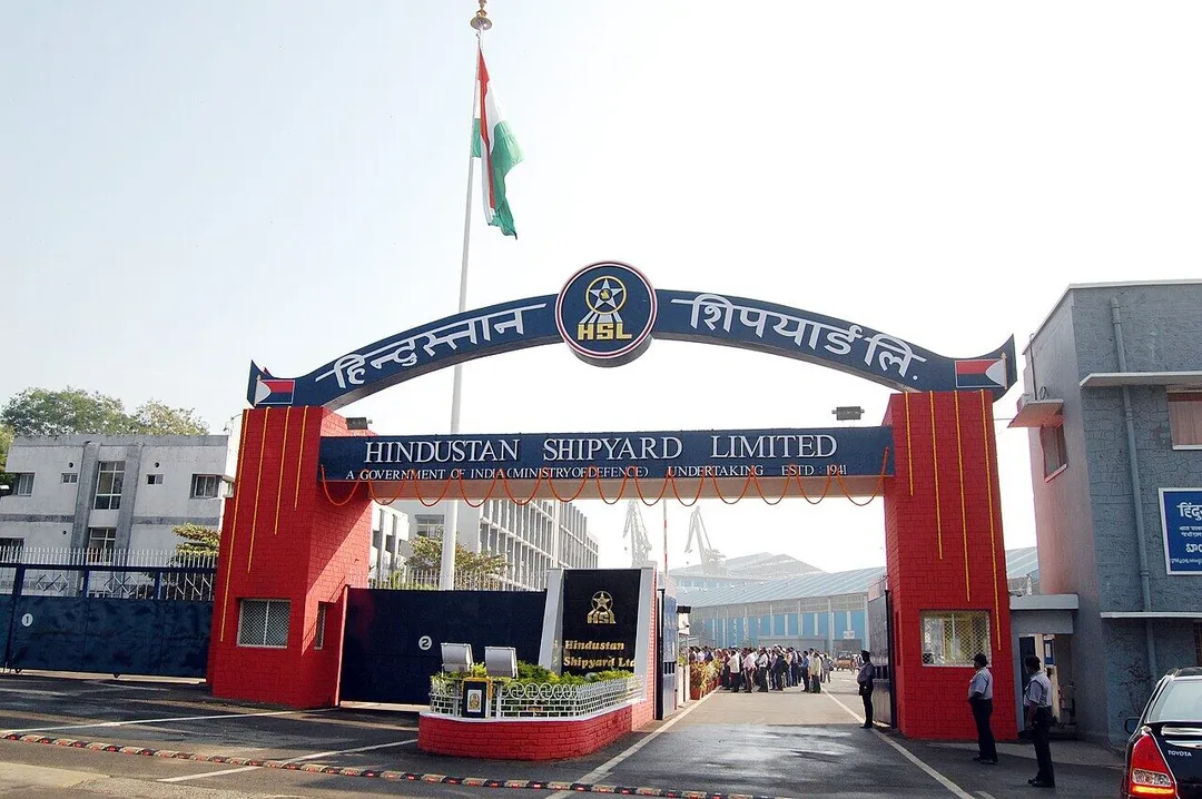
Photo: Prof Ranga Sai · CC0 · via Wikimedia Commons
Trusted by 200+ organisations across India & overseas — including





























Few Indian cities pack as much infrastructure into as tight a strip as Visakhapatnam. Between the hills and the sea run port land, rail sidings, conveyor corridors, product pipelines, a naval base, APIIC estates and dense housing. Since the 2022 split the district is eleven mandals with GVMC as its only urban local body. Whoever manages land, networks or field assets here holds the information as drawings in one office and spreadsheets in another.
WebGIS puts that information on one interactive map in a browser. We build on open technology such as PostGIS, Leaflet, OpenLayers and QGIS, so there is no per-seat licence and you own the application. Features include layered asset maps with search, field data capture from a phone with GPS tagging, spatial reports, and links to ERP or maintenance records.

Case studies
BrahMos Aerospace Thiruvananthapuram Ltd (BATL)
BrahMos (BATL) — Secure, Auditable ERPNext Finance & Procurement

Kerala State Road Transport Corporation (KSRTC)
KSRTC — ERPNext Courier System Delivered ₹1 Crore in Profit

Queue Off
Queue Off — Digital Payments That Work on a Feature Phone, With No Internet
A spreadsheet can list every valve, pole or plot, but it cannot show which ones lie along a road being widened. Placing assets on a shared map lets planners answer location questions in seconds and spot conflicts before work begins.
Inspection teams fill paper forms that reach the office days later, if at all. A mobile capture app records the observation, photo and position on site and syncs it to the central map, so the office sees progress the same day.
Engineering, estates and operations often maintain separate drawings that disagree. One authoritative map with controlled editing rights ends the argument about which version is current and eases handover to new staff.
An example
A utilities contractor holds a maintenance contract covering pipelines and pumping points across Padmanabham mandal, the rural north of the district. On Monday two surveyors set out with the capture app on their phones. At each valve chamber they record the condition, take a photo and let the GPS fix the point; where the signal drops between villages, the entries wait on the phone and sync at the next tower. By evening the engineer in the city office sees the day's inspections as coloured points on the map, three flagged for repair. The work orders raised from those points carry the coordinates, so Wednesday's repair crew drives to the chamber, not to a description of it.
A WebGIS project starts with your existing data: drawings, shapefiles, spreadsheets with coordinates, survey outputs. We review these remotely and show a first map of your own assets early, which sharpens the requirement better than any document. Development happens in Kochi. For Visakhapatnam clients with field teams, we visit to train surveyors on the capture app in the conditions they really work in.
Discovery and data audit. Your spatial data and the decisions the map must support.
Data model. Your data modelled in a spatial database, clean and ready to scale.
Map and application design. Layers, filters, search, dashboards and field capture around your users.
Integration. The map connected to your ERP, asset registers and GPS feeds.
Deploy, train and support. Launched on a stack you control, your team trained, support kept on.
The scope and timeline are agreed in writing before work starts.
Port and maritime logistics
Maps of yards, berths, leased plots, utilities and roads for port users and logistics park operators, showing occupancy, lease details and maintenance status by clicking on a parcel.
Oil refining and petrochemicals
Pipeline and corridor mapping for operators and their maintenance contractors, with inspection records, right-of-way details and encroachment observations tied to the exact stretch of line.
Tourism and civic services
Visitor-facing maps of beaches and viewpoints, and internal maps for agencies managing amenities and sanitation along the coast from RK Beach to Bheemili, updated from the field.
No. We build on open, standards-based GIS software that carries no per-user fee. You keep the code and the data. If some departments already use desktop GIS tools, the web system exchanges data with them through standard formats.
Usually yes. CAD drawings can be georeferenced and converted, and paper maps scanned and digitised, though old sheets need checking against ground positions. For sites around Vizag we assess a sample first and tell you how much cleaning the data needs.
No. Any organisation whose assets or customers are spread over an area can benefit: logistics parks, utilities contractors, property developers and transport operators. If your operation fits on a single site, a map probably adds little, and we will say so.
After a first conversation about your spatial data, the users and the decisions the map has to support, we agree the scope and send you a written quotation. The price, the deliverables and the timeline are fixed against that scope before any work starts, so nothing grows without your sign-off.
You speak to someone who does this work, not a call centre. They ask about the data you hold, who needs to see it on a map and what they decide from it. If it looks like a fit, we agree the scope and put it in writing, with the timeline, before any work starts. If it does not, we tell you.
Greater Visakhapatnam Municipal Corporation (GVMC)local body
The district's only urban local body governs a city of about 19.6 lakh people by the 2011 Census on today's boundaries, with roads, drains, lighting and amenities that contractors maintain by location.
Visakhapatnam Porttransport
natural-harbour major port under the Visakhapatnam Port Authority; inner harbour with 22 berths and outer harbour with 8; largest on the east coast
Thirty berths, leased plots, sidings and roads across the inner and outer harbour make a working map the practical way to manage occupancy, utilities and maintenance.
Source: en.wikipedia.orgPadmanabham mandallocal body
One of the district's rural mandals in the north, where water lines, roads and field assets are spread across villages and a paper survey takes days to reach the office.
Visakhapatnam Rural mandallocal body
The mandal covering the city's expanding northern belt, where new layouts, utilities and roads are added faster than any department's drawings are updated.
Places and organisations are named for local context only. Acube Innovations is not affiliated with or endorsed by them.
Everything about WebGIS Development All services in Visakhapatnam
More services in Visakhapatnam
Get a clear plan, an honest timeline, and a fixed scope. Talk to a real expert today — whether or not you work with us.
or write to info@acube.co
Kochi (Kadavanthra & Infopark) · Thiruvananthapuram · across India & overseas · In business since 2011