
Loading…
Loading…
Also serving Alleppey
Alappuzha is a district of water, bunds and polders where location decides almost everything; WebGIS puts the fields, canals, routes and assets on one shared map.
Or call +91 62358 66111
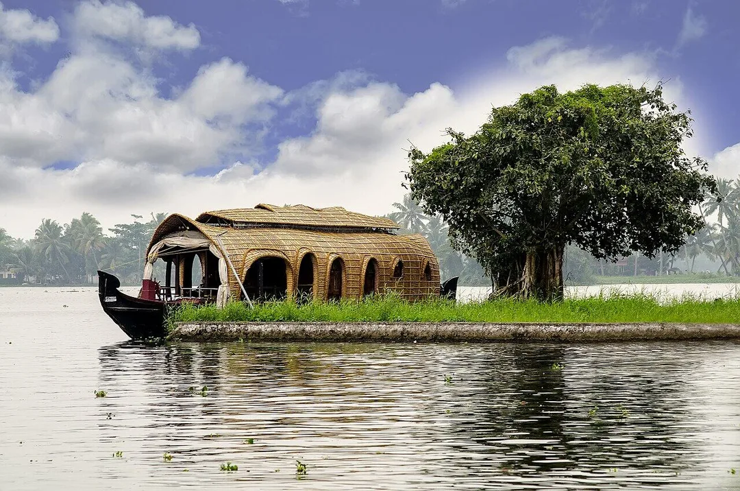
Photo: Frank van Dijk · Pexels License · via Pexels
Trusted by 200+ organisations across India & overseas — including





























Few districts are as shaped by geography as Alappuzha. Kuttanad's paddy fields are polders, called padasekharams, kept dry by outer bunds and pumps. Canals serve as roads. Hundreds of houseboats share the same stretches of water. Flood levels, salinity, bund breaches and waste from boats are constant concerns, and the people responsible for them work mostly from paper maps, registers and memory.
WebGIS development from Acube produces interactive web maps and spatial dashboards on open GIS technology, including PostGIS, QGIS and OpenLayers, so there is no per-seat mapping licence. Field data is collected on phones with GPS and appears on the central map. In Alleppey the likely users are local bodies, farming collectives, fisheries and tourism agencies and larger operators, and we would not pretend every small firm needs one.
Case studies

Kerala State Road Transport Corporation (KSRTC)
KSRTC — ERPNext Courier System Delivered ₹1 Crore in Profit

Dumas Bakes N Meals Private Limited
Dumas Bakes N Meals — ERPNext Lifted On-Time Deliveries by Over 40%

Indus Motor Company Private Limited
Indus Motor — ERPNext Cut Stock-Outs 40% Across Showrooms
Each padasekharam has its area, its farmers, its pumps, bund condition and crop calendar recorded in committee books. Mapped as layers, the same information shows which polders have sown, where bunds need repair, and where machinery should go next.
When water rises, officials need to know which wards, roads and relief camps are affected and who lives there. A map with elevation, past flood extents, shelters and boat resources supports quicker decisions than a list of place names.
Houseboat routes, jetties, mooring points and treatment locations are known informally. Mapping them, with GPS tracks where available, helps regulators and operator associations manage congestion, safety and pollution on the busiest stretches.
An example
A pump operator on a Kuttanad bund finds seepage on a Tuesday morning. He opens the map on his phone, taps the point where he is standing, chooses the bund from the layer already drawn, adds two photographs and a line of description, and sends it. At the block office the engineer sees the pin appear on the same map, with the polder, the committee contact and the last repair recorded against that stretch. He can see which other bunds in the ward were flagged this month and which relief camps lie downstream. The site visit is planned that afternoon instead of the following week.
A WebGIS project starts with the data you already hold: survey sheets, shapefiles, spreadsheets of place names, even scanned maps. We review these with your team in Alappuzha, agree the layers and the users, and build a first working map quickly so that feedback is about something real. Hosting, field training and later additions come from our Kochi team.
Discovery and data audit. Your spatial data and the decisions the map must support.
Data model. Your data modelled in a spatial database, clean and ready to scale.
Map and application design. Layers, filters, search, dashboards and field capture around your users.
Integration. The map connected to your ERP, asset registers and GPS feeds.
Deploy, train and support. Launched on a stack you control, your team trained, support kept on.
The scope and timeline are agreed in writing before work starts.
Kuttanad paddy farming
A polder-level map for agriculture offices and padasekharam committees, showing sowing and harvest status, pump and bund assets, procurement points and harvester movement, updated from the field by phone during the season.
Seafood and inland fisheries
Maps of landing centres, fish farms, clam beds and cage culture sites, with licence details and survey data attached, for fisheries officials, cooperatives and research teams. Salinity readings can be added as a further layer.
Backwater and houseboat tourism
Route, jetty and mooring maps for tourism and port authorities and for larger operators, with live boat positions where GPS is fitted, and public maps that help visitors find authorised boarding points.
No. We build on open-source GIS components, so there are no per-user mapping fees, and the application and data belong to you. If your department already uses a commercial GIS, we exchange data with it in standard formats.
The system is used through an ordinary browser and a phone app, and needs no GIS specialist for daily work. We train your staff, provide Malayalam labels where needed, and remain available for support. Complex analysis can be done by us on request.
For most small firms, honestly, no. It becomes useful for operators with many boats or vehicles to follow, for aquaculture spread over several sites, and for utilities or contractors managing assets across the district. We would advise a simpler tool for anyone else.
After a first conversation about your spatial data, the users and the decisions the map has to support, we agree the scope and send you a written quotation. The price, the deliverables and the timeline are fixed against that scope before any work starts, so nothing grows without your sign-off.
You speak to someone who does this work, not a call centre. They ask about the data you hold, who needs to see it on a map and what they decide from it. If it looks like a fit, we agree the scope and put it in writing, with the timeline, before any work starts. If it does not, we tell you.
Alappuzha District Panchayatlocal body
District-level planning here means choosing between wards and blocks that flood very differently, which is a map question before it is ever a budget question.
Ambalappuzha Block Panchayatlocal body
A block running from the coast to the paddy lands holds asset registers for roads, canals and pumps that make sense only when they are drawn rather than listed.
Champakkulam Block Panchayatlocal body
Champakkulam sits among the polders, where every bund, pump and access route is known locally and recorded nowhere another department can see it.
Chengannur Municipalitylocal body
The eastern town handles pilgrim traffic and river flooding in the same months, so a shared map of routes, camps and low points serves both.
Places and organisations are named for local context only. Acube Innovations is not affiliated with or endorsed by them.
Everything about WebGIS Development All services in Alappuzha
More services in Alappuzha
Get a clear plan, an honest timeline, and a fixed scope. Talk to a real expert today — whether or not you work with us.
or write to info@acube.co
Kochi (Kadavanthra & Infopark) · Thiruvananthapuram · across India & overseas · In business since 2011