
Loading…
Loading…
Also serving Trichur
In Thrissur, WebGIS is less about city planning than about branch networks: lenders and hospital groups deciding where to open next, and which field routes make sense.
Or call +91 62358 66111
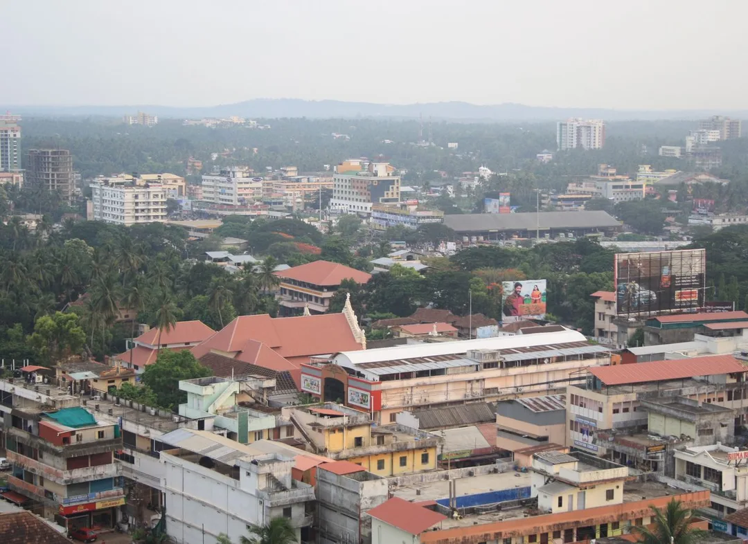
Photo: Jpullokaran · CC BY-SA 3.0, cropped · via Wikimedia Commons
Trusted by 200+ organisations across India & overseas — including





























Thrissur is not an obvious market for mapping software, and we will not pretend that every business here needs it. The honest uses are specific. Finance companies run from the town operate branch networks that stretch across states, and decisions about where to open, merge or send collection staff are geographic questions usually answered from a list. The municipal corporation manages drains, roads and streetlights across its wards. Research institutions at Peechi and Vellanikkara collect field data across forests and farms.
WebGIS development means building map-based web applications on open technology: PostGIS, Leaflet, OpenLayers and QGIS. Your own data becomes layers that can be filtered, searched and analysed in a browser, with field capture from a phone. Because the stack is open source, there is no per-seat mapping licence.
Case studies

Indus Motor Company Private Limited
Indus Motor — ERPNext Cut Stock-Outs 40% Across Showrooms

Della Fashions
Della Fashions — ERPNext POS Made Checkout 60% Faster Across Every Outlet

Queue Off
Queue Off — Digital Payments That Work on a Feature Phone, With No Internet
A new branch location is often chosen because a director knows the town. Plotting existing branches, customer addresses and competitor presence on one map shows overlaps and gaps plainly, and turns the expansion meeting into a discussion of evidence.
Collection agents visit customers in an order that made sense years ago. With customers geocoded, routes can be grouped by area and day, visits logged with location, and a supervisor can see which pockets are being missed.
Municipal engineers in Thrissur still refer to paper sheets for drains, streetlights and road assets. A web map of those assets, updated from the field, lets the office answer a complaint by looking up what exists at that spot and when it was last repaired.
An example
A finance company's directors meet on a Tuesday in Thrissur to decide the next two branch openings. For years the choice was made from a list of towns and a director's instinct. This time the wall screen shows a map: every existing branch, every customer address geocoded from the loan book, the coastal highway through Kodungallur and the trunk road to Chalakudy, and a layer of competitor branches gathered from public listings. The gaps are visible at once. A stretch along the coast has customers travelling far to the nearest branch; a town the directors favoured already has three competitors and few of the company's own customers. The collection routes for the proposed branch are drawn from the same customer points before anyone is hired. The meeting ends with two locations, and the reasons are on the map rather than in a memory.
A WebGIS project starts with your data, not with a map. We review what you hold, such as addresses, survey sheets and spreadsheets with place names, and tell you what can be mapped reliably. A working prototype on a sample follows quickly so that you can judge the value. We meet in Thrissur for the review; the development is done from Kochi.
Discovery and data audit. Your spatial data and the decisions the map must support.
Data model. Your data modelled in a spatial database, clean and ready to scale.
Map and application design. Layers, filters, search, dashboards and field capture around your users.
Integration. The map connected to your ERP, asset registers and GPS feeds.
Deploy, train and support. Launched on a stack you control, your team trained, support kept on.
The scope and timeline are agreed in writing before work starts.
Banking and financial services
Branch and customer distribution maps, catchment analysis for proposed locations, territory allocation for collection and sales staff, and visit logs with coordinates feeding a supervisor's dashboard.
Education and healthcare
Patient catchment maps that show a hospital group where its cases come from and where an outreach clinic would help, and field-survey tools for university and research teams working in farms, forests and wetlands.
Tiles and ceramics
For makers on the Ollur belt with dealers across central Kerala, a dealer map with sales by area, delivery clustering for lorries leaving the works, and a view of towns where the brand has no outlet yet.
It can be. If you have a handful of branches, a spreadsheet is fine. Once locations run into the dozens and field staff into the hundreds, geography starts costing money through overlap and wasted travel. We will tell you honestly which side of that line you sit on.
To a useful degree, usually. Pincode and locality give an approximate position that is good enough for catchment and territory analysis. Exact points can be captured gradually as field staff visit, using the phone's location at the customer's door.
No. We build on open-source components and open base maps, so there is no recurring per-user licence. You pay for the development and the hosting. The application, its code and its data belong to you.
After a first conversation about your spatial data, the users and the decisions the map has to support, we agree the scope and send you a written quotation. The price, the deliverables and the timeline are fixed against that scope before any work starts, so nothing grows without your sign-off.
You speak to someone who does this work, not a call centre. They ask about the data you hold, who needs to see it on a map and what they decide from it. If it looks like a fit, we agree the scope and put it in writing, with the timeline, before any work starts. If it does not, we tell you.
Thrissur Municipal Corporationlocal body
A corporation managing drains, roads and streetlights across its wards has exactly the asset and complaint data that a web map, updated from the field, turns into answers.
Kerala Forest Research Institute, Peechiinstitution
tropical forestry research institute founded in 1975
Field research across forest areas produces survey points, plots and observations that belong on a web map with capture from a phone rather than in spreadsheets with place names.
Source: kfri.res.inKerala Agricultural University, Vellanikkarainstitution
state agricultural university headquartered near Mannuthy, functioning since 1972
Farm trials, extension work and soil and crop surveys across the district are geographic data, and a browser-based map lets researchers and extension staff share and analyse them.
Source: en.wikipedia.orgNational Highway 66 via Kodungallurtransport
coastal highway linking Kodungallur to Kochi (36 km) and the Malabar coast
The coastal corridor is where a lender's branch and customer map often shows the widest gaps between where customers live and where the nearest branch is.
Source: en.wikipedia.orgPlaces and organisations are named for local context only. Acube Innovations is not affiliated with or endorsed by them.
Everything about WebGIS Development All services in Thrissur
More services in Thrissur
Get a clear plan, an honest timeline, and a fixed scope. Talk to a real expert today — whether or not you work with us.
or write to info@acube.co
Kochi (Kadavanthra & Infopark) · Thiruvananthapuram · across India & overseas · In business since 2011