
Loading…
Loading…
Also serving Kovai
Coimbatore is a fast-spreading city with old tanks, new layouts and a forest edge; WebGIS gives its planners, utilities and estate managers one shared map in place of scattered drawings.
Or call +91 62358 66111
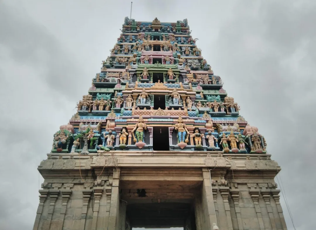
Photo: Thamizhpparithi Maari · CC BY-SA 4.0, cropped · via Wikimedia Commons
Trusted by 200+ organisations across India & overseas — including


























WebGIS is not something every Coimbatore business needs, and a machine shop in Ganapathy can safely skip it. The need is real elsewhere. The city has grown outward along Avinashi Road, Saravanampatti and Trichy Road faster than its records. Water arrives from the Siruvani and Pilloor schemes through networks mapped on paper. Tanks along the Noyyal are being restored. Layouts are approved, sold and resold.
WebGIS development puts such information on an interactive map in a browser: layers for assets, land, networks and field data, with search, filters and analysis. We build on open technology such as PostGIS, QGIS, Leaflet and OpenLayers, so there is no per-seat GIS licence. For Kovai organisations the usual starting point is one department's assets, mapped properly.

Case studies

BrahMos Aerospace Thiruvananthapuram Ltd (BATL)
BrahMos (BATL) — Secure, Auditable ERPNext Finance & Procurement

Indus Motor Company Private Limited
Indus Motor — ERPNext Cut Stock-Outs 40% Across Showrooms

Della Fashions
Della Fashions — ERPNext POS Made Checkout 60% Faster Across Every Outlet
Water and drainage lines laid over decades are remembered by a few senior staff and drawn on sheets that disagree. Capturing them once on a shared map, with valves, ages and repair history, means a leak is located from a screen and not from memory.
Managers of industrial estates and private parks keep plot allotments, dues and utility connections in registers. A map of the estate linked to each plot's record shows vacancy, arrears and infrastructure at a glance, and answers an investor's query in minutes.
Survey teams collect data on paper or in phone apps that do not sync. A mobile capture tool with GPS tagging sends each record to the central map the same day, with photographs, so the office sees progress as it happens.
An example
A water supply complaint comes in from a street in Saravanampatti on a Tuesday morning, an area laid out faster than anyone drew it. The junior engineer opens the browser map, sees the pipeline, its age, the valves that isolate the stretch and the recent repairs on it, and sends a crew with the valve locations on their phones. Meanwhile a field team surveying tank bunds along the Noyyal uploads boundary points and photographs from the capture app, and they appear on the central map before the team returns. In the afternoon an estate manager answers an investor's query about vacant plots and power connections from the same kind of map, in minutes, without opening the ledger.
A WebGIS engagement in Coimbatore begins with a data audit: what maps, drawings, spreadsheets and GPS records exist, and how reliable they are. That is best done on a visit from Kochi. Database design, map building and integration with ERP or asset systems are done remotely, with regular demos. We return to train field staff on the capture app, since that training works far better outdoors than on a call.
Discovery and data audit. Your spatial data and the decisions the map must support.
Data model. Your data modelled in a spatial database, clean and ready to scale.
Map and application design. Layers, filters, search, dashboards and field capture around your users.
Integration. The map connected to your ERP, asset registers and GPS feeds.
Deploy, train and support. Launched on a stack you control, your team trained, support kept on.
The scope and timeline are agreed in writing before work starts.
Urban local bodies and utilities
Asset maps for water supply, drainage, street lighting and roads, property and ward layers, complaint locations plotted for pattern analysis, and dashboards for engineers and commissioners.
Industrial estates and real estate
Plot-level maps for SIDCO and CODISSIA estates and private developers, showing allotment, occupancy, utilities and approvals, with a public view for prospective buyers where wanted.
Farming and the Pollachi coconut belt
Farm boundary mapping for producer companies and large growers, procurement routes, well and irrigation records, and plot-wise yield history that can be seen by season.
No. We build on open, standards-based GIS components, so there are no per-user licence fees and you own the system. Existing shapefiles, CAD drawings, spreadsheets with coordinates and GPS data can all be imported. If you already hold a commercial licence, the two can coexist.
Rarely, and we would say so. It earns its place when assets or customers are spread over an area: a dealer and service network plotted by territory, a fleet, or a group with many sites. For a single-plant manufacturer, an ERP is the better investment.
Yes. Live GPS feeds, asset registers and ERPNext records can appear as layers, so location and status are seen together. A Coimbatore utility could, for example, view open complaints, crew positions and asset age on one screen.
After a first conversation about your spatial data, the users and the decisions the map has to support, we agree the scope and send you a written quotation. The price, the deliverables and the timeline are fixed against that scope before any work starts, so nothing grows without your sign-off.
You speak to someone who does this work, not a call centre. They ask about the data you hold, who needs to see it on a map and what they decide from it. If it looks like a fit, we agree the scope and put it in writing, with the timeline, before any work starts. If it does not, we tell you.
Coimbatore Municipal Corporationlocal body
A corporation of this size holds water, drainage, road and lighting assets across many wards, mostly on drawings that disagree with each other.
Source: coimbatore.nic.inCoimbatore Market Committee regulated marketsmarket
19 regulated agricultural markets under the committee, including Coimbatore (Ramanathapuram), Pollachi, Kinathukadavu, Anaimalai and Sulur — coconut, cotton, maize, jaggery, groundnut
The committee's regulated markets at Pollachi, Kinathukadavu, Anaimalai and Sulur; mapping their catchments and yards gives a picture that registers cannot.
Source: agritech.tnau.ac.inNational Highways 544, 948, 81, 181 and 83transport
five national highways meet at Coimbatore, linking Salem–Kochi, Bengaluru (via Sathyamangalam), Ooty, Pollachi–Dindigul and Palakkad
Five highways meet here; roadside assets, service networks and dealer territories along them are what fleet, utility and distribution maps are drawn around.
Source: en.wikipedia.orgValparai Municipalitylocal body
A hill town of tea estates and forest edge, where estate boundaries, roads and field records are the natural first layer of a WebGIS.
Source: coimbatore.nic.inPlaces and organisations are named for local context only. Acube Innovations is not affiliated with or endorsed by them.
Everything about WebGIS Development All services in Coimbatore
More services in Coimbatore
Get a clear plan, an honest timeline, and a fixed scope. Talk to a real expert today — whether or not you work with us.
or write to info@acube.co
Kochi (Kadavanthra & Infopark) · Thiruvananthapuram · across India & overseas · In business since 2011